Dateiliste
Diese Spezialseite listet alle hochgeladenen Dateien auf.
Erste Seite |
Vorherige Seite |
Nächste Seite |
Letzte Seite |
| Datum | Name | Vorschaubild | Größe | Benutzer | Beschreibung | Versionen |
|---|---|---|---|---|---|---|
| 08:47, 26. Mai 2020 | Disy Cadenza Datenanalyse Reporting GIS.jpg (Datei) | 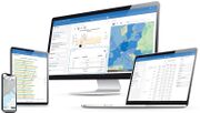 |
48 KB | Disy-Marketing | Disy Informationssysteme GmbH | 1 |
| 10:11, 1. Jun. 2018 | Asseco Logo-TOMS.jpg (Datei) | 711 KB | FKutter | 1 | ||
| 10:09, 1. Jun. 2018 | Asseco Logo-AG Portal.jpg (Datei) | 701 KB | FKutter | 1 | ||
| 10:07, 1. Jun. 2018 | Asseco Logo-WFMS.jpg (Datei) | 707 KB | FKutter | 1 | ||
| 10:04, 1. Jun. 2018 | Asseco Logo-Lids.jpg (Datei) |  |
712 KB | FKutter | 1 | |
| 10:02, 1. Jun. 2018 | Asseco Logo-Samo.jpg (Datei) | 711 KB | FKutter | 1 | ||
| 09:42, 1. Jun. 2018 | Asseco BERIT - Logo.png (Datei) | 32 KB | FKutter | 1 | ||
| 16:53, 30. Mai 2018 | LIDS.png (Datei) | 6 KB | FKutter | Zurückgesetzt auf die Version vom 10. Mai 2013, 08:16 Uhr | 3 | |
| 16:19, 30. Mai 2018 | Asseco Berit.png (Datei) | 35 KB | FKutter | 8 | ||
| 10:17, 10. Mai 2013 | TOMS.png (Datei) | 7 KB | FKutter | Asseco BERIT GmbH, Mannheim, Frank Kutter, Geschäftsführer | 1 | |
| 18:43, 7. Mär. 2011 | Conference - Management of Geosites - ISGM2011.pdf (Datei) |  |
169 KB | HeinzJ | 1 | |
| 16:20, 5. Jul. 2010 | Nijmegen-Wesel Variante-südl-Büderich.PDF (Datei) | Nijmegen-Wesel_Variante-südl-Büderich.PDF | 5,66 MB | Marcus | 1 | |
| 14:23, 5. Jul. 2010 | Nijmegen-Wesel Büderich-Wesel A4.PDF (Datei) | Nijmegen-Wesel_Büderich-Wesel_A4.PDF | 5,64 MB | Marcus | 2 | |
| 14:46, 21. Mai 2010 | Regiograph logo.png (Datei) |  |
43 KB | Gerritschreiber | RegioGraph - Logo (Geschütztes Markenzeichen) | 1 |
| 14:37, 21. Mai 2010 | Regiograph screen 600px.gif (Datei) | 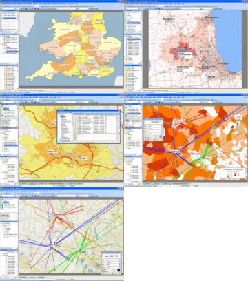 |
454 KB | Gerritschreiber | Scrennshot der Aktuellen Version RegioGraph Planung Quelle: GfK GeoMarketing | 1 |
| 15:17, 11. Dez. 2009 | Geopublisher1.3 with explanations2.png (Datei) | 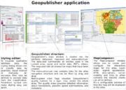 |
881 KB | Alfonx2 | 1 | |
| 13:49, 11. Dez. 2009 | AtlasStyler13.png (Datei) | 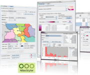 |
281 KB | Alfonx2 | AtlasStyler 1.3 screenshots. Made by myself. | 1 |
| 12:54, 11. Nov. 2009 | Polymap.png (Datei) |  |
63 KB | Polymap | 1 | |
| 14:19, 25. Okt. 2009 | 10ES231 10 GIS Programm.pdf (Datei) |  |
420 KB | HeinzJ | GIS in der Wasserwirtschaft 20./21. Januar 2010, Bonn DWA-Impulse im Geodatennetzwerk der Wasserwirtschaft 7. GIS-TAGUNG | 1 |
| 08:27, 6. Okt. 2009 | NETMng.png (Datei) | 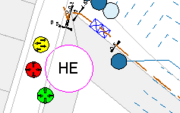 |
4 KB | Mk tki | 1 | |
| 15:14, 5. Okt. 2009 | NETRohr.png (Datei) | 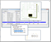 |
129 KB | Mk tki | 1 | |
| 14:53, 5. Okt. 2009 | NETLageplan.png (Datei) | 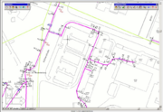 |
489 KB | Mk tki | 1 | |
| 14:10, 5. Okt. 2009 | NETFM.png (Datei) | 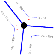 |
54 KB | Mk tki | NET-FM Darstellung in der Grafik | 1 |
| 13:30, 5. Okt. 2009 | NETLogo.png (Datei) |  |
7 KB | Mk tki | NET-Logo | 1 |
| 13:17, 5. Okt. 2009 | NETModule.png (Datei) |  |
10 KB | Mk tki | Der modulare Aufbau von NET | 1 |
| 15:57, 6. Mär. 2009 | Solmeta Geotagger N2.jpg (Datei) | 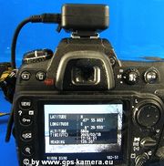 |
101 KB | Gps-camera.eu | Foto-GPS Solmeta Geotagger N2 mit Kompass auf Nikon D300. Quelle: S. Hofer MBK GmbH, www.gps-camera.eu. Selbst gemacht. | 1 |
| 15:24, 9. Dez. 2008 | Namibia.jpg (Datei) |  |
46 KB | Fgrt45 | 1 | |
| 14:13, 5. Dez. 2008 | Toms.jpg (Datei) | 5 KB | FKutter | BERIT GmbH (Deutschland) | 1 | |
| 14:12, 5. Dez. 2008 | LIDS.jpg (Datei) |  |
4 KB | FKutter | BERIT GmbH (Deutschland) | 1 |
| 14:12, 5. Dez. 2008 | Berit-Asseco.png (Datei) |  |
94 KB | FKutter | BERIT GmbH (Deutschland) | 1 |
| 20:23, 14. Okt. 2008 | Var nymphe 3.gif (Datei) |  |
21 KB | Tschang | Die Nymphe Kalypso | 1 |
| 21:38, 8. Sep. 2008 | Cc88x31.png (Datei) |  |
5 KB | HeinzJ | 1 | |
| 21:38, 8. Sep. 2008 | Openjump interpolation5.png (Datei) | 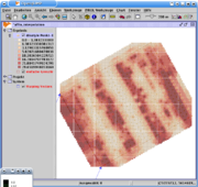 |
108 KB | HeinzJ | Quelle: http://turbo.uni-hohenheim.de/wiki/index.php?title=Interpolation_mit_JUMP&oldid=1449 Die Texte im Wiki [http://turbo.uni-hohenheim.de/wiki/ Runder Tisch GIS Hohenheim] von User:MartinWeis und anderen stehen unter einer [http://creativecommons | 1 |
| 21:38, 8. Sep. 2008 | Openjump interpolation4.png (Datei) | 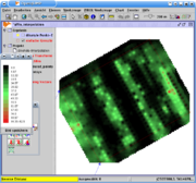 |
62 KB | HeinzJ | Quelle: http://turbo.uni-hohenheim.de/wiki/index.php?title=Interpolation_mit_JUMP&oldid=1449 Die Texte im Wiki [http://turbo.uni-hohenheim.de/wiki/ Runder Tisch GIS Hohenheim] von User:MartinWeis und anderen stehen unter einer [http://creativecommons | 1 |
| 21:37, 8. Sep. 2008 | Openjump interpolation3.png (Datei) | 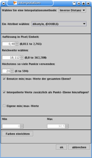 |
16 KB | HeinzJ | Quelle: http://turbo.uni-hohenheim.de/wiki/index.php?title=Interpolation_mit_JUMP&oldid=1449 Die Texte im Wiki [http://turbo.uni-hohenheim.de/wiki/ Runder Tisch GIS Hohenheim] von User:MartinWeis und anderen stehen unter einer [http://creativecommons | 1 |
| 21:37, 8. Sep. 2008 | Openjump interpolation2.png (Datei) | 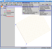 |
42 KB | HeinzJ | Quelle: http://turbo.uni-hohenheim.de/wiki/index.php?title=Interpolation_mit_JUMP&oldid=1449 Die Texte im Wiki [http://turbo.uni-hohenheim.de/wiki/ Runder Tisch GIS Hohenheim] von User:MartinWeis und anderen stehen unter einer [http://creativecommons | 1 |
| 21:37, 8. Sep. 2008 | Openjump interpolation1.png (Datei) | 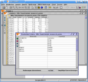 |
47 KB | HeinzJ | Quelle: http://turbo.uni-hohenheim.de/wiki/index.php?title=Interpolation_mit_JUMP&oldid=1449 Die Texte im Wiki [http://turbo.uni-hohenheim.de/wiki/ Runder Tisch GIS Hohenheim] von User:MartinWeis und anderen stehen unter einer [http://creativecommons | 1 |
| 21:29, 8. Sep. 2008 | Openjump affinetrans7.png (Datei) | 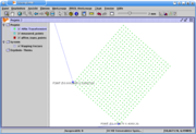 |
40 KB | HeinzJ | Quelle: http://turbo.uni-hohenheim.de/wiki/index.php?title=Affintransformation_mit_JUMP&oldid=1448 [http://creativecommons.org/licenses/by-sa/3.0/de/ Creative Commons License] Bild:Cc88x31.png Lizenz: http://turbo.uni-hohenheim.de/wiki/index.php/Ru | 1 |
| 21:28, 8. Sep. 2008 | Openjump affinetrans6.png (Datei) | 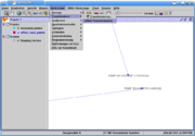 |
36 KB | HeinzJ | Quelle: http://turbo.uni-hohenheim.de/wiki/index.php?title=Affintransformation_mit_JUMP&oldid=1448 [http://creativecommons.org/licenses/by-sa/3.0/de/ Creative Commons License] Bild:Cc88x31.png Lizenz: http://turbo.uni-hohenheim.de/wiki/index.php/Ru | 1 |
| 21:28, 8. Sep. 2008 | Openjump affinetrans5.png (Datei) | 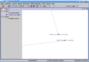 |
34 KB | HeinzJ | Quelle: http://turbo.uni-hohenheim.de/wiki/index.php?title=Affintransformation_mit_JUMP&oldid=1448 [http://creativecommons.org/licenses/by-sa/3.0/de/ Creative Commons License] Bild:Cc88x31.png Lizenz: http://turbo.uni-hohenheim.de/wiki/index.php/Ru | 1 |
| 21:28, 8. Sep. 2008 | Openjump affinetrans4.png (Datei) | 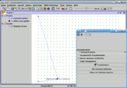 |
19 KB | HeinzJ | Quelle: http://turbo.uni-hohenheim.de/wiki/index.php?title=Affintransformation_mit_JUMP&oldid=1448 [http://creativecommons.org/licenses/by-sa/3.0/de/ Creative Commons License] Bild:Cc88x31.png Lizenz: http://turbo.uni-hohenheim.de/wiki/index.php/Ru | 1 |
| 21:28, 8. Sep. 2008 | Openjump affinetrans3.png (Datei) | 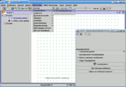 |
18 KB | HeinzJ | Quelle: http://turbo.uni-hohenheim.de/wiki/index.php?title=Affintransformation_mit_JUMP&oldid=1448 [http://creativecommons.org/licenses/by-sa/3.0/de/ Creative Commons License] Bild:Cc88x31.png Lizenz: http://turbo.uni-hohenheim.de/wiki/index.php/Ru | 1 |
| 21:28, 8. Sep. 2008 | Openjump affinetrans2.png (Datei) | 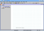 |
33 KB | HeinzJ | Quelle: http://turbo.uni-hohenheim.de/wiki/index.php?title=Affintransformation_mit_JUMP&oldid=1448 [http://creativecommons.org/licenses/by-sa/3.0/de/ Creative Commons License] Bild:Cc88x31.png Lizenz: http://turbo.uni-hohenheim.de/wiki/index.php/Ru | 1 |
| 21:27, 8. Sep. 2008 | Openjump affinetrans1.png (Datei) |  |
29 KB | HeinzJ | Quelle: http://turbo.uni-hohenheim.de/wiki/index.php?title=Affintransformation_mit_JUMP&oldid=1448 [http://creativecommons.org/licenses/by-sa/3.0/de/ Creative Commons License] Bild:Cc88x31.png Lizenz: http://turbo.uni-hohenheim.de/wiki/index.php/Ru | 1 |
| 22:15, 16. Jul. 2008 | Topographic map example.png (Datei) | 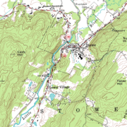 |
152 KB | HeinzJ | Quelle: http://en.wikipedia.org/wiki/Image:Topographic_map_example.png == English description == An inset from the USGS topographic map of Stowe, Vermont, USA, featuring 20-foot contour intervals. The scale is 1:24,000. == Source and copyrights == '''So | 1 |
| 17:12, 2. Apr. 2008 | 800px-Flag of Sweden.svg.png (Datei) |  |
3 KB | HeinzJ | Quelle: http://de.wikipedia.org/wiki/Bild:Flag_of_Sweden.svg | 1 |
| 16:07, 27. Dez. 2007 | Stop sign.png (Datei) |  |
5 KB | HeinzJ | Quelle: http://de.wikipedia.org/wiki/Bild:Stop_sign.png | 1 |
| 16:05, 27. Dez. 2007 | PD-icon.svg (Datei) | 1 KB | HeinzJ | Quelle: http://upload.wikimedia.org/wikipedia/commons/6/62/PD-icon.svg | 1 | |
| 16:03, 27. Dez. 2007 | Albers-equal-area-conic.png (Datei) |  |
21 KB | HeinzJ | == Beschreibung, Quelle == {{Information |Beschreibung=Dastellung der Erdoberfläche in der Albers Kegelprojektion |Quelle=Selber hergestellt unter Benützung von MATLAB |Urheber=de:Benutzer:Phmeier |Datum=22.01.2007 |Genehmigung= |Andere Versionen= | 1 |
| 22:44, 29. Mär. 2007 | RTGIS.jpg (Datei) |  |
24 KB | Danioefi | 1 |
Erste Seite |
Vorherige Seite |
Nächste Seite |
Letzte Seite |